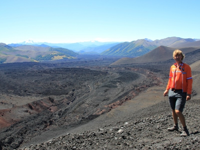
After another restday, forced by the bad weather, we did a sidetrip to the next vulcano; Lonquimay. The town is at an altitude of about 950 meters (3000 ft) and we had to go up to 1815 meters (5500 ft), where a hike to a sidecrater of the volcano started. The volcano last erupted in December 1988 and on Christmasday of that year, there was a second eruption from this sidecrater.
The whole 21 kms (12 miles) to the beginning of the hike was uphill. The first part went through forest, but the last 5 kms (3 miles) we cycled through a moonlike landscape with many dunes; all blackened due to the lavastones and lavarocks. And it kept going up and up.
The hike was only 3 kms (2 miles) and not very hard, but we had to scramble up a steep section of loose rocks and sand. Then we arrived at the top of the crater which was pretty deep and there were large cracks inside. It’s a strange thought that once there was a huge hole with bubbling and boiling lava. The lavaflow was very well visible from above. We also had a great view on the surroundings; on both ends of the lavafield there were mountains and green forests.


Jullie hoeven geen spijt te hebben van dit tripje naar de vulkaan, geweldig wat een prachtig gebied.
Ik kan me voorstellen dat je door dit natuurgeweld je ontzettend nietig gaat voelen.
De foto’s laten dit in ieder geval wel zien.
In ieder geval sliepen jullie wel veilig met de waak lama’s voor de tent. Ik zou ze maar meenemen!!!.
Liefs.
Hoi, Mooie verre reizen, maar het is wel de bedoeling dat jullie wat opschrijven. Nu weten we niet of je op een berg met vulkaan zit of ergens in een immens mooi dal.
Veel plezier en we zien het nieuws tegemoet. groet de windjes en beppe.